Visualizzazione post con etichetta vulcano. Mostra tutti i post

venerdì 29 maggio 2026

Nel ventre verde del vulcano - The volcano's green womb


photos by Grazia M for Sicilia MC


Sul fianco orientale dell'Etna, a circa 3 km dal centro della cittadina di Zafferana Etnea, il corpo del vulcano sembra rientrare all'improvviso. Come se un risucchio improvviso abbia tirato verso l'interno rocce, boschi e sentieri inghiottendoli in un tunnel verde che si chiama... Valle San Giacomo.

Valle San Giacomo è in realtà il risultato di millenni di erosione su antichissime lave, derivate - come la vicina Val Calanna - dal collasso dell'antica cima del vulcano. Ha una forma a V e si innalza fino a 1200 metri (partendo da 730 m) tra boschi di castagni, lecci, faggi, roverelle, querce, aceri, pioppi e ginestre. Ai lati si elevano due costoni lavici, Cugno di Mezzo e Monte Fior di Cosimo, che la separano da un'altra vallata gemella (Valle Cavasecca). Durante l'inverno, le ripide pareti che formano la valle raccolgono le acque piovane dai boschi e le convogliano nel torrente stagionale San Giacomo che poi entra nell'abitato di Zafferana assumendo però il nome di torrente Salaro.

Nel cuore della Valle San Giacomo, nel XII secolo, venne fondato un luogo di eremitaggio chiamato Priorato di San Giacomo, a cui si affiancava la chiesetta di San Giacomo Apostolo. Distrutti entrambi dal terremoto del 1693, vennero ricostruiti in seguito in forma di villa residenziale e privata. Intorno a quell'antico priorato, però, si formò il primissimo villaggio che avrebbe dato vita alla attuale città di Zafferana Etnea. Le rovine della villa (ex priorato) si trovano tutt'ora, abbandonate, lungo la via che sale dal centro alla Valle San Giacomo.

A pochi metri dall'imbocco del sentiero della valle si trova la colata lavica che nel 1992 raggiunse quasi l'abitato di Zafferana. Ai suoi piedi, una statua della Madonna e... un più prosaico centro di degustazione dei prodotti tipici dell'Etna (miele, marmellate, vini).


On the eastern flank of Mount Etna, about 3 km from the center of the town of Zafferana Etnea, the volcano appears to suddenly retreat. As if a sudden suction has pulled rocks, forests, and paths inward, swallowing them into a green tunnel called... Valle San Giacomo.

Valle San Giacomo (St James Valley) is actually the result of millennia of erosion on ancient lava flows, resulting—like the nearby Val Calanna—from the collapse of the volcano's ancient summit. It has a V-shape and rises up to 1,200 meters (starting from 730 m) through forests of chestnut, holm oak, beech, downy oak, oak, maple, poplar, and broom. On either side rise two lava ridges, Cugno di Mezzo and Monte Fior di Cosimo, separating it from another twin valley (Valle Cavasecca). During the winter, the steep walls that form the valley collect rainwater from the woods and channel it into the seasonal San Giacomo stream, which then flows into the town of Zafferana, becoming the Salaro river.

In the very heart of the San Giacomo valley, a hermitage called the Priory of San Giacomo was founded in the 12th century, alongside the small church of St James the Apostle. Both were destroyed by the 1693 earthquake and later rebuilt as a residential and private villa. Around that ancient priory, however, the very first village formed, which would later give rise to the present-day town of Zafferana Etnea. The ruins of the villa (former priory) still stand, abandoned, along the road that climbs from the town center to the San Giacomo valley.

A few meters from the entrance to the valley trail is the lava flow that almost reached the town of Zafferana in 1992. At its feet, a sacred statue of the Virgin Mary and... a much more "secular" tasting center for typical Etna products (honey, jams, wines).

lunedì 26 agosto 2024

Vulcani "non vulcani" di Sicilia - Sicilian volcanoes-non-volcanoes


photo Sicilia MC 2024


TESTO SCRITTO ANCHE  PER IL BLOG GO ETNA

L’Etna è un vulcano. Lo sappiamo tutti, lo si vede chiaramente e di certo non ci permette di dimenticarlo con le sue eruzioni periodiche e spettacolari. La forma conica, i crateri sommitali, il fumo costantemente visibile … queste caratteristiche sono comuni a molte altre montagne simili. Riconosciamo facilmente un vulcano: lo Stromboli lo è, anche il Vesuvio – seppure silente – lo lascia capire benissimo. Ma ci sono alcuni luoghi che lasciano aleggiare il dubbio: ma questo, è un vulcano oppure no? E se lo è, è un vulcano “vero”? In Sicilia di questi luoghi misteriosi ne abbiamo almeno quattro: le Salinelle, le Maccalube, il Monte Kronio e l’isola di Lipari.

SALINELLE E MACCALUBE

Situati un po’ su tutto il territorio dell’isola, secondo una sorta di diagonale che parte da sud ovest e termina a est, questi mini vulcani che eruttano fango e acqua sono delle vere  proprie attrazioni turistiche. Le Salinelle si trovano a Paternò, in provincia di Catania, le Maccalube invece tra Agrigento e Caltanissetta. Sono la stessa cosa? Ma soprattutto … sono vulcani?

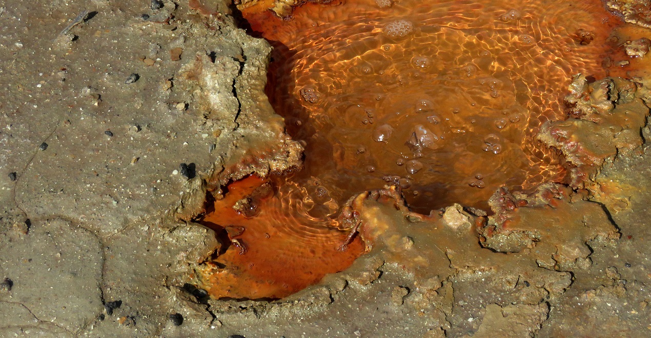
Le Salinelle di Paternò sono un vero mistero perché racchiudono in sé tutte le caratteristiche dei fenomeni post-vulcanici e vulcanico-secondari. Si tratta quasi certamente di ciò che resta di un vulcano antico e sono alimentate da cunei tettonici che formano il fronte più avanzato della Falda di Gela. Quando sono “in quiete” emettono acque sulfuree e gas, quando eruttano emettono getti di fango misto ad altri minerali.

Le Maccalube, che si trovano tra i territori di Agrigento e Caltanissetta (le più famose sono quelle di Aragona), sono un fenomeno è legato alla presenza di terreni argillosi che vengono invasi nel sottosuolo da acqua salmastra spinta dal gas metano.  Si chiama “vulcanesimo sedimentario”, ovvero caratteristiche simili a quelle dei vulcani veri ma alimentate dai gas e non dal fuoco. Quindi definire le Maccalube dei “vulcani” non è corretto.

MONTE KRONIO

Sempre in provincia di Agrigento, nel territorio di Sciacca, sorge una collina rocciosa chiamata Monte San Calogero-Monte Kronio. In cima alla collina è stato costruito un santuario da sempre famoso per le sue “fonti curative” che si collegano alle terme di Sciacca. In cima al monte Kronio, in particolare, esistono degli sfiati di vapori caldi che da sempre la gente utilizza per curare malanni respiratori. Un tempo di libero accesso, oggi invece sono regolati da un ingresso a pagamento. Gli studi intorno al monte Kronio non hanno rilevato mai presenze di lave o lapilli. Quindi si può dire che questo non sia un vero vulcano ma il risultato del movimento di faglie tettoniche che ha generato l’emersione di rocce e sfiati.

ISOLA DI LIPARI

L’isola di Lipari non è un vulcano … pensano tutti. Perché nessuno l’ha mai vista eruttare, né si è mai assistito a fenomeni come sfiati, esplosioni e fumarole. D’altronde, l’intera isola è popolata, coltivata e non ci sono tracce visibili di alcuna attività. Eppure l’ultima eruzione certificata a Lipari risale al 1230, quindi ad “appena” 794 anni fa… che in termini geologici è davvero molto poco! Ciò significa che questo vulcano non può considerarsi “spento”… ma dormiente.

In particolare, il sorvegliato speciale è Monte Pilato. Questo cono, tra quelli presenti a Lipari, è il cratere che ha eruttato più spesso in tempi “recenti”. Si parla delle eruzioni dell’anno 780, dell’anno 1230 e anche di una serie di esplosioni verificatesi nel XVI secolo. Il problema è che queste eruzioni si distanziano tra loro di secoli, per cui la gente del posto “ne perde memoria”. E infatti, oggi, Monte Pilato è abitato e coperto da campi coltivati. I turisti che arrivano lo ammirano da ogni lato, inconsapevoli di ammirare in realtà un vero e proprio vulcano che un giorno … non si sa quando… tornerà ad eruttare!

 ----------------------------------------------------

Mount Etna is a volcano. We all know it, we can see it clearly and it certainly does not allow us to forget it with its periodic and spectacular eruptions. The conical shape, the summit craters, the constantly visible smoke ... these characteristics are common to many other similar mountains. We easily recognize a volcano: Stromboli is a volcano, so is the Vesuvius - although silent – they let us understand it very well. But there are some places that leave the doubt hovering: is this a volcano or not? And if so, is it a "real" volcano? In Sicily we have at least four of these mysterious places: the Salinelle, the Maccalube, Mount Kronio and the island of Lipari.

SALINELLE AND MACCALUBE

Crossing throughout the territory of the island, according to a sort of diagonal that starts from the southwest and ends in the east, these mini volcanoes that erupt mud and water are real tourist attractions. The Salinelle are located in Paternò, in the district of Catania, the Maccalube instead between Agrigento and Caltanissetta. Are they the same thing? But above all ... are they volcanoes?

The Salinelle of Paternò are a real mystery because they contain all the characteristics of post-volcanic and secondary volcanic phenomena. They are almost certainly what remains of an ancient volcano and are fed by tectonic wedges that form the most advanced front of the Gela Fault. When they are "quiet" they emit sulphurous waters and gas, when they erupt they emit jets of mud mixed with other minerals.

The Maccalube, which are located between the territories of Agrigento and Caltanissetta (the most famous are in Aragona), are a phenomenon linked to the presence of clay soils that are invaded underground by brackish water pushed by methane gas. It is called "sedimentary volcanism", that is characteristics similar to those of real volcanoes but fed by gas, not by fire. So calling the Maccalube “volcanoes” is not correct.

MT KRONIO

Also in the district of Agrigento, in the territory of Sciacca, there is a rocky hill called Monte San Calogero-Monte Kronio. At the top of the hill a sanctuary has been built that has always been famous for its “healing springs” that connect to the Sciacca spa. At the top of Mount Kronio, in particular, there are vents of hot steam that people have always used to treat respiratory diseases. Once freely accessible, today they are regulated by an entrance fee. Studies around Mount Kronio have never detected the presence of lava or lapilli. So we can say that this is not a real volcano but the result of the movement of tectonic faults that generated the emergence of rocks and gas vents.

LIPARI

The island of Lipari is not a volcano … everyone thinks. Because no one has ever seen it erupt, nor have phenomena such as vents, explosions and fumaroles ever been witnessed. After all, the entire island is populated, cultivated and there are no visible traces of any activity. Yet the last certified eruption in Lipari dates back to 1230, so “just” 794 years ago… which in geological terms is really a short time ago! This means that this volcano cannot be considered “extinguished”… but dormant. In particular, the one under special surveillance is Mount Pilato hill. This cone, among those present in Lipari, is the crater that has erupted most often in “recent” times. We refer to the eruptions in the year 780, year 1230 and also a series of explosions that occurred in the 16th century. The problem is that these eruptions are spaced out by centuries, so the locals “lose memory of them”. In fact, today, Lipari’s Mount Pilato is inhabited and covered with cultivated fields. The tourists who arrive on holiday here, they admire it from every side, unaware that they are actually looking at a real volcano. And this volcano one day... no one knows when... will erupt again!

THIS ARTICLE WAS ALSO WRITTEN FOR THE BLOG "GO ETNA"


sabato 2 gennaio 2021

Le nostre isole 6: USTICA


PHOTO BY  FABROX - wikipedia


Ustica è conosciuta nel mondo per due fatti in particolare: i fondali stupendi, paradiso dei sub di ogni nazione e la terribile strage causata dall'abbattimento di un aereo civile in tempo di pace, proprio nei cieli sopra l'isoletta. Oggi vogliamo però conoscere meglio questo lembo di terra al largo di Palermo, in Sicilia.

Ustica - dal latino ustum, bruciato - nasce come isola vulcanica e per 600.000 anni, nella preistoria, ha eruttato lave incandescenti. Lave diverse, però, da quelle delle vicine isole Eolie; infatti Ustica è un vulcano più simile all'Etna che alle isole vulcaniche del Tirreno. In ogni caso, al momento, i suoi due massimi crateri, Punta Maggiore e Monte Guardia dei Turchi, sono spenti. L'apparato vulcanico di cui Ustica è una parte emersa, però, è ancora attivo e non è raro che il mare intorno all'isola ogni tanto si veda letteralmnte "bollire".

Le tantissime grotte laviche e le cave scavate dall'erosione del mare hanno reso Ustica da sempre un luogo adatto all'insediamento umano. Ci sono testimonianze di vita nel Paleolitico, tracce di primitivi culti Cristiani nell'era Romana, segnali del passaggio di pirati e mercenari del Medioevo che tra quelle grotte trovavano rifugio scappando dalla legge. Dopo un lungo periodo di abbandono, nel 1759, Ferdinando III di Borbone re delle Due Sicilie decise un piano di colonizzazione dell'isola incentivando l'immigrazione di contadini e pescatori da Palermo, da Trapani ma anche da Napoli. Dopo l'Unità d'Italia fu usata come prigione a cielo aperto per gli esiliati e per i prigionieri in isolamento, condizione che decadde solo nel 1961.

Oggi Ustica vive di pesca e di turismo, ma è diffusa anche l'agricoltura. L'unico centro abitato è il comune di Ustica, raccolto intorno all'unico porticciolo dell'isola. Qui si possono ammirare monumenti del Settecento, come la chiesa di San Ferdinando, le torri militari di avvistamento (Torre Santa Maria, Torre Spalmatore). Non lontano dal centro sorgono siti archeologici come Villaggio Tramontana con necropoli dell'era del bronzo, o Villaggio Rocca Falconiera con resti romani e resti militari del XVIII secolo. A Ustica però si viene per immergersi e ammirare i fondali ricchi di coralli e aragoste; o per ammirare le grotte (Grotta Verde, Grotta Azzurra, Grotta dell'Oro, Grotta Colonne....) e ovviamente le splendide spiagge.

Nel giugno del 1980 un aereo civile della compagnia ITAVIA in volo da Bologna verso Palermo precipitò, forse colpito per errore da fuoco militare alleato durante non meglio specificate "esercitazioni nel Tirreno". Morirono 81 persone. L'aereo - al centro di uno dei misteri politici e militari più oscuri d'Italia - cadde in realtà molto lontano dall'isola, ma oggi l'evento è ricordato come STRAGE DI USTICA perché Ustica è da sempre il punto di riferimento più vicino sulle mappe di quella tragedia.

COME ARRIVARE: a Ustica si arriva dal mare, con aliscafi che partono da Palermo.


PHOTO BY PAOLO LUPO

Ustica is known throughout the world for two facts in particular: the wonderful seabed, a paradise for divers of every nation and the terrible air crash caused by the shooting down of a civilian plane in peacetime, in the skies above the island. Today, however, we want to learn more about this strip of land off the coast of Palermo, in Sicily.

Ustica - from the Latin ustum, burned - was born as a volcanic island and for over 600,000 years, in prehistoric times, it erupted hot lavas. Different lava, however, from the one of the nearby Aeolian islands; in fact Ustica is more similar to Etna than to the other volcanic islands of the Tyrrhenian Sea. In any case, at the moment, its two maximum craters, Punta Maggiore and Monte Guardia dei Turchi, are extinct. The volcanic apparatus of which Ustica is an emerged part, however, is still active and it is not uncommon for the sea around the island to literally "boil" every now and then. 

The many lava caves and the grottos dug by sea erosion have always made Ustica a suitable place for human settlement. There are testimonies of life in the Paleolithic Age, traces of primitive Christian cults in the Roman era, signs of the passage of pirates and mercenaries of the Middle Ages who found refuge among those caves escaping from the law. After a long period of abandonment, in 1759, Ferdinand III of Bourbon, king of the Two Sicilies, decided on a plan to colonize the island by encouraging the immigration of farmers and fishermen from Palermo, Trapani and Naples. After the unification of Italy it was used as an open-air prison for exiles and for prisoners in solitary confinement, a condition that declined only in 1961.

Today Usticans live thanks to fishing and tourism, plus some agriculture too. The only inhabited center is the municipality of Ustica, gathered around the only port on the island. Here you can admire monuments of the 18th century, such as the church of St Ferdinando, the military watchtowers (Torre Santa Maria, Torre Spalmatore). Not far from the town there are archaeological sites such as the Tramontana Village with the Bronze Age necropolis, or the Rocca Falconiera Village with Roman remains and military remains from the 18th century. However, people come to Ustica mainly to dive and admire the seabed rich in corals and lobsters; or to admire the caves (Grotta Verde, Grotta Azzurra, Grotta dell'Oro, Grotta Colonne ....) and of course the splendid beaches. 

In June 1980 a civil aircraft of the ITAVIA company flying from Bologna to Palermo crashed, perhaps accidentally hit by Allied military fire during unspecified "exercises in the Tyrrhenian Sea". The victims were 81, no one survived. The airplane - still at the center of one of the darkest political and military mysteries in Italy - actually fell very far from the island. But today the event is remembered as the USTICA CRASH because Ustica has always been the closest point of reference on the maps of that tragedy. 

HOW TO GET THERE: Ustica can be reached from the sea, with hydrofoils departing from Palermo.

domenica 30 agosto 2020

Le nostre isole 3: STROMBOLI


                                              PHOTOS BY GRAZIA MUSUMECI


STROMBOLI è un nome di origine greca (strongyle) che significa "rotondo", "trottola" e fa riferimento alla forma del piccolo vulcano-isola situato nel mar Tirreno, tra la Sicilia e la Calabria. Amministrativamente Stromboli fa parte della provincia siciliana di Messina, e del comune di Lipari, nelle Eolie. Geograficamente è solo la punta di un gigantesco vulcano - alto più di 3000 metri - ma sommerso per tre quarti. Trattandosi di un vulcano relativamente "giovane" ha una attività molto intensa e soprattutto continua.

Il cratere sommitale di Stromboli produce esplosioni di lava a ritmi abbastanza regolari, una ogni 15, 20 o 30 minuti circa, a seconda dei periodi. Raramente, ma anche improvvisamente, produce le cosiddette "esplosioni maggiori", ovvero la liberazione di enormi bolle di gas e lava che mettono seriamente in pericolo la popolazione dell'isola. L'ultima di considerevole entità è avvenuta nel luglio del 2019, causando anche la morte di una guida del posto. Le esplosioni di questo vulcano sono diventate l'esempio per descrivere altri fenomeni vulcanici simili, in tutto il mondo: si parla infatti di "eruzioni stromboliane".

Abitata dai tempi dei Greci e dei Romani, nel corso dei secoli l'isola ha subito anche periodi di spopolamento, a causa di siccità o di eruzioni distruttive. Tra gli anni Venti e Quaranta del XX secolo molti abitanti emigrarono in Australia e solo di recente, grazie al turismo, è tornata a popolarsi. Oggi conta circa 600 abitanti.

A Stromboli si viene per godere del mare, sulle splendide spiagge, o per tentare la salita al vulcano, accessibile fino a circa la metà della sua altezza (400 metri su 924). Le escursioni in quota avvengono quasi sempre di pomeriggio, dalle 17 fino all'ora del tramonto. Splendide anche le escursioni in barca alla Sciara del Fuoco, il grande muro di lava lungo il quale scende il fuoco delle eruzioni, direttamente in mare. Da visitare, a Stromboli: la chiesa di San Vincenzo, la chiesa di San Bartolo, la Casa di Ingrid Bergman-Museo del Cinema, la Biblioteca di Stromboli, il Villaggio Preistorico, il Mulino e la Grotta della spiaggia Piscità, la sabbia nera di Ficogrande. Non perdetevi l'emozione di una passeggiata a Ginostra, villaggio di pescatori raggiungibile soltanto via mare.


Per arrivare a Stromboli: gli aliscafi e le navi partono sia da Messina che da Milazzo e Napoli. Raggiungibile anche con collegamenti dalle altre isole Eolie. UNA CURIOSITA': Stromboli è protagonista, insieme all'Etna, di una serie di vignette che si possono visionare a questo LINK.  


STROMBOLI is a name of Greek origin (strongyle) which means "round", "spinning top" and refers to the shape of the small volcano-island located in the Tyrrhenian Sea, between Sicily and Calabria. Administratively Stromboli is part of the Sicilian district of Messina, and of the municipality of Lipari - Aeolian Islands. Geographically it is only the tip of a gigantic volcano - more than 3000 meters high - but submerged for three quarters. Being a relatively "young" volcano, it has a very intense and above all continuous activity. The summit crater of Stromboli produces lava explosions at fairly regular rates, one every 15, 20 or 30 minutes, depending on the period. Rarely, but even suddenly, it produces the so-called "major explosions", that is the release of huge bubbles of gas and lava that seriously endanger the population of the island. The last major one occurred in July 2019, also resulting in the death of a young local guide. The explosions of this volcano have become the example to describe other similar volcanic phenomena, all over the world: in fact, we speak of "Strombolian eruptions".

Inhabited since the times of the Greeks and Romans, over the centuries it has also suffered periods of depopulation, due to drought or destructive eruptions. Between the1920s and 1940s many inhabitants emigrated to Australia and only recently, thanks to tourism, the island has been populated again. Today it has about 600 inhabitants. Tourists come to Stromboli to enjoy the sea, on the splendid beaches, or to try the climb to the volcano, accessible up to about half of its height (400 meters out of 924). Excursions at high altitude almost always take place in the afternoon, from 5pm until sunset. Also splendid are the boat excursions to the Sciara del Fuoco, the great wall of lavic rock along which the lava descends directly into the sea, during the eruptions. Places to visit, in Stromboli: the church of San Vincenzo, the church of San Bartolo, the House of Ingrid Bergman- Museum of Cinema, the Library of Stromboli, the Prehistoric Village, the Mill and the Grotto of the Piscità beach, the black sand of  Ficogrande beach. Do not miss a walk in the romantic Ginostra village, which you can only reach by boat.

To get to Stromboli: hydrofoils and ships depart from Messina and from Milazzo and Naples. Also reachable with connections from the other Aeolian islands. A CURIOSITY: Stromboli is the main character of funny cartoons you can see - only in Italian, though - at this link.

martedì 9 giugno 2020

Le nostre isole 1: VULCANO - Minor islands

                            all photos by--- grazia m  per SICILIA MUSE CULTURE


INIZIAMO CON QUESTO ARTICOLO UNA MINI SERIE PERIODICA DEDICATA ALLE ISOLE MINORI DELLA SICILIA.
                                                                       ------------

L'isola di VULCANO non potrete dimenticarla mai più. Vi lascia letteralmente il suo odore addosso. Odore di zolfo. 
Vulcano è una delle "sette sorelle", le sette isole dell'arcipelago delle Eolie, a nord delle coste tirreniche della Sicilia. Territorialmente fa parte del comune di Lipari (Messina) ed è la prima isola che si incontra arrivando con l'aliscafo da Milazzo o da Messina.

Nella preistoria, questa era un'isola-cimitero. Sono state trovate testimonianze di riti funebri, ma nessuna traccia di cadaveri. Forse perché le salme venivano portate qui soltanto per una sorta di "purificazione" per poi essere seppellite nelle isole di appartenenza, o forse perché venivano poi gettate nel cratere, nelle pozze di zolfo e dunque consumate dai vapori vulcanici.
Per i Romani era questo l'accesso al regno di Efesto, prima di identificarlo nel cratere dell'Etna. Il nome di questo dio greco per i latini divenne "Vulcano" e da questo nome, e dall'isoletta che per prima lo portò, deriva il termine che oggi identifica tutte le montagne simili nel mondo e tutte le attività (vulcanologia, vulcanesimo, vulcanico...) ad esse connesse.

Un'isola importante quindi, la piccola Vulcano, ma soprattutto un'isola bellissima.
Ad oggi conta una popolazione di appena 715 abitanti, discendenti di pescatori e contadini siciliani sbarcati qui nel XIX secolo, dopo che per anni l'isola era rimasta disabitata, o adibita a carcere di lavori forzati o ancora -nel secolo XI -  ad eremitaggio.
Il territorio è formato da diversi crateri vulcanici: Monte Ara, Monte Saraceno e Forgia Vecchia ormai spenti, Monte della Fossa e Vulcanello ... quest'ultimo collegato al resto dell'isola da una lingua di terra formatasi in seguito. Monte della Fossa e Vulcanello emettono ancora vapori e fanghi sulfurei.
Le eruzioni di Vulcano avvengono dopo lunghi intervalli di tempo. Si ricordano in particolare quelle del II secolo avanti Cristo, quando si formò Vulcanello, quelle del 1727 e 1739, del 1783 e l'ultima nel 1888.

Proprio i fanghi di zolfo di Vulcano la rendono turisticamente attraente. Non solo per i benefici termali che se ne traggono ma per i colori spettacolari che assumono le rocce, dal bianco, al rosso, al giallo al verde.  Il turismo è la prima attività economica dell'isola, la seconda invece è l'agricoltura, non la pesca. Su Vulcano si coltivano le viti e si produce un ottimo vino Malvasia.

DA NON PERDERE: la spiaggia delle SABBIE NERE, con un'acqua caldissima e pulitissima; le pozze dei FANGHI SULFUREI se volete curare reumatismi e problemi della pelle con questi fanghi benefici; IL PAESE con le sue viuzze romantiche, le piazzette formato mini e le case colorate e originali, come il simpatico "grattacielo" - un semplice piano terra più mansarda!


LET'S START A MINI PERIODIC SERIES DEDICATED TO THE MINOR ISLANDS OF SICILY.

                                                                       ------------
   
You will never forget the island of VULCANO. It literally leaves its smell on you. Sulfur
smell.
Vulcano is one of the "seven sisters", the seven islands of the Aeolian archipelago, north of the Tyrrhenian coast of Sicily. It is part of the municipality of Lipari (Messina) and it is the first island you come across when arriving by hydrofoil from Milazzo or Messina. In prehistoric ages, this was a cemetery-island. Evidences of funeral rites were found here, but no trace of corpses. Perhaps because the dead people were brought here only for a sort of "purification" to then be buried in the islands of belonging. Or perhaps because they were then thrown into the crater, in the sulfur pools and therefore consumed by volcanic vapors. 
For the Romans this was access to the kingdom of Hephaestus, before identifying it in the crater of Etna. The name of this Greek god for the Latins soon became "Vulcano" . From this name, and from this islet, the term derives that identifies all the similar mountains in the world, today. And all activities (volcanology, volcanism, volcanic ...) connected to them. An important island therefore, the small Vulcano, but above all a beautiful place too. To date, it has a population of just 715 inhabitants, descendants of Sicilian fishermen and peasants who landed here in the 19th century. At that time the island had been abandoned for centuries, when not used as a prison for forced labors or even - in the 11th century - as a hermitage.

The territory is made up of several volcanic craters: Mount Ara, Mount Saraceno and Forgia Vecchia now extinct, Mount della Fossa and Vulcanello ... the latter connected to the rest of the island by a strip of land. Mount della Fossa and Vulcanello still emit sulphurous vapors and mud. The eruptions of Vulcano happen rarely. History reminds of that of the 2nd century BC, of 1727 and 1739, 1783 and the last one in 1888.

The mud of Vulcano makes it touristically attractive. Not only for the thermal benefits that are derived from it but also for the spectacular colours of the rocks, going from white to red to yellow and to green. Tourism is the first economic activity on the island, the second is agriculture, not fishing. On Vulcano the vines are grown and they produce here an excellent Malvasia wine. 
NOT TO BE MISSED: the beach of the BLACK SANDS, with nice warm and clean water; the pools of sulphurous MUD if you want to treat rheumatism and skin problems with these beneficial natural cures; THE VILLAGE with its romantic alleys, mini-sized squares and colourful and original houses, such as the nice "skyscraper" - a simple ground floor-plus-attic little house!

mercoledì 27 maggio 2020

Boschi di Sicilia - Sicilian Woods

                                                 LE FOTO SONO DI SICILIA MUSE CULTURE

Per tanto tempo i film e i romanzi ve l'hanno dipinta come una terra di pascoli aridi, scogliere  bruciate dal sole e rocce. Ma la Sicilia è anche boschi, bellissime foreste in miniatura che sembrano catapultare in mondi nuovi e lontanissimi. Invece siete sempre qui, nel cuore del cuore del Mediterraneo.

In fondo, quando giunsero qui i Greci la Sicilia era un'isola verde. I Romani tagliarono migliaia di alberi per costruire le navi da guerra, e con tutto ciò non riuscirono a disboscarla. Infatti, all'arrivo sull'isola, gli Arabi la definirono "Paradiso", o anche "Aziza" (la meravigliosa) per quanto erano floridi i suoi boschi.  Siccità e incuria unite alla mancanza di rispetto umana dei tempi moderni hanno infine ridotto il verde della Sicilia al minimo. Ma non lo hanno fatto sparire, per fortuna.

Tra i boschi più belli della Sicilia sono quelli del Parco dei Nebrodi, enorme riserva naturale - oggi per fortuna protetta- che copre i territori di tre province: Messina, Enna e parte di Catania. Con i suoi 86.000 ettari è sicuramente l'insieme di boschi più grande dell'isola. Le immense distese di verde custodiscono una fauna selvatica di rara bellezza e non è difficile incontrare cinghiali, maialini neri o addirittura cavalli allo stato brado che corrono liberi sui sentieri! I boschi del Parco dei Nebrodi fanno da corona anche a diversi laghetti, i più famosi: Lago Tre Arie, Maulazzo e Biviere.

Spostandosi verso Palermo invece si incontrano le Madonie e il meraviglioso Bosco della Ficuzza. Il territorio di questa area verde protetta si estende da Corleone a Monreale, in provincia di Palermo, ed è una delle poche aree protette da sempre. Era infatti "Riserva di Caccia Reale" fin dal tempo dei re di Sicilia.

Sulla costa orientale, i boschi più belli si trovano in provincia di Catania, sull'Etna. La pineta Ragabo, sul fianco settentrionale del vulcano, è il più affascinante con i suoi pini alti anche 15 metri. Risponde sul fianco sud la Pineta di Nicolosi. In territorio di Milo si trova il Bosco Scarbaglio, oggi divenuto parco suburbano comunale. Sul fianco ovest, in zona Piano dei Grilli, si cammina in una macchia particolare: quella delle profumatissime ginestre.

Altri boschi siciliani sono: Bosco Santo Pietro (vicino Caltagirone), la Sughereta di Niscemi, il Bosco del Pino di Aleppo tra Comiso e Ragusa, sui Monti Sicani, Bosco di Alcamo (Trapani). Quest'ultimo contiene al suo interno il Parco Avventura delle Madonie. Una citazione a parte merita il minuscolo "Bosco di Aci" ad Aci Sant'Antonio (Catania): si tratta del residuo minimo di una foresta molto antica, quella che fornì la maggior parte del legname ai Romani durante la loro dominazione in Sicilia. Resta invece solo il nome dell'antica foresta che circondava l'attuale cittadina messinese di Floresta.


For a long time films and novels have painted it as a land of dry pastures, sunburnt cliffs and rocks. But Sicily is also woods, beautiful miniature forests that seem to catapult you into new and very distant worlds. Instead you are always there, in the heart of the heart of the Mediterranean.
After all, when the Greeks came here Sicily was a green island. The Romans cut thousands of trees to build warships, and with all this they failed to deforest it thoroughly. In fact, upon their arrival on the island, the Arabs called Sicily "a Paradise", or even "Aziza" (the marvelous) for the beautiful flourishing of so many forests. Drought and neglect combined with the lack of human respect in modern times have finally reduced the green of Sicily to a minimum. But they did not make it disappear, fortunately.

Among the most beautiful woods in Sicily are those of the Nebrodi Park, a huge nature reserve - fortunately protected today - which covers the territories of three provinces: Messina, Enna and part of Catania. With its 86,000 hectares it is certainly the largest set of forests on the island. The immense expanses of greenery preserve a wildlife of rare beauty. It is not difficult to meet wild boars, black pigs or even wild horses that run free on the paths! The woods of the Nebrodi Park also crown several ponds, the most famous: Lake Tre Arie, Lake Maulazzo and the Biviere. Moving towards Palermo instead you will find the Madonie Range and the wonderful Ficuzza Wood. The territory of this protected green area extends from Corleone to Monreale, in the province of Palermo, and is one of the few protected areas ever since. It was in fact a "Royal Hunting Reserve" since the time of the kings of Sicily, back in the Middle Ages.

On the east coast, the most beautiful woods are located in the province of Catania, on Mount Etna. The Ragabo pine forest, on the northern side of the volcano, is the most fascinating with its pine trees that reach 15 meters height. The Pine Forest of Nicolosi answers on the southern side. In the territory of Milo you find the  Scarbaglio Wood, which has now become a municipal suburban park. On the west side, in the Piano dei Grilli area, you walk through a particular spot: that of the fragrant gorse trees. Other Sicilian woods are: Bosco Santo Pietro (near Caltagirone), the Sughereta of Niscemi, the Aleph pine wood between Comiso and Ragusa, on the Sicani Mountains, Bosco di Alcamo (Trapani). The latter contains the Madonie Adventure Park. The tiny "Bosco di Aci" in Aci Sant'Antonio (Catania) deserves a separate mention: it is the minimum residue of a very ancient forest, the one that supplied most of the wood to the Romans during their domination in Sicily. Instead, there is no more trace of the ancient forest that surrounded the present messinese town of Floresta. Only the town's name - meaning in fact "forest" -  remains today as a memory.

venerdì 24 aprile 2020

I Pàlici di Palagonia - The legend of the twin lakes


Quando il Dio rese feconda la Ninfa di Fuoco, ecco che nacque Palagonia!

In provincia di Catania esiste davvero un paese con questo nome, Palagonia. Nome che, quasi certamente, deriva da una leggenda mitologica legata a due misteriose divinità ... i Pàlici. Secondo alcune versioni greche, i Pàlici erano i figli gemelli di Zeus e Talia. Altre leggende però li fanno risalire alle culture esistenti in Sicilia prima dell'arrivo degli ellenici. In quel caso i due Pàlici sarebbero invece i figli del dio siculo Adranos, unitosi alla ninfa Etna.

Nel luogo in cui i due gemelli furono generati tra vapori e fumi di zolfo, in realtà si trovavano due laghetti vulcanici oggi prosciugati - ma non per questo estinti! Di Lago Vulcano e Lago Naftìa esistono dipinti e testimonianze storiche, ma oggi non si possono più vedere in quanto sono stati interrati e coperti da strade e sentieri di campo. Se ne sente ancora l'odore di zolfo, però, di tanto in tanto. E non cresce nulla nella zona in cui un tempo i laghi ribollivano di fanghi caldi.

Anticamente, queste semi divinità erano considerate molto miracolose, sia dai Siculi che dai Greci e dai Romani dopo di loro. Ai Pàlici era dedicato il tempio di Paliké, situato a pochi metri dai laghi gemelli, e ad essi si portavano sacrifici affinché benedicessero il raccolto. Ma i Pàlici erano anche i protettori degli schiavi. Se un servo maltrattato, o accusato ingiustamente, si fosse rifugiato nel tempio di Paliké nessuno poteva toccarlo. Il padrone poteva farli uscire solo testimoniando, davanti ad altre persone, di trattarli bene da quel momento in poi.

Nessuno osava sfidare i Pàlici, perché tutti - anche i potenti - temevano le loro esplosioni di ira e soprattutto i loro fumi velenosi che uccidevano o accecavano chiunque osasse avvicinarsi troppo.  Era uso punire i prigionieri ribelli mettendoli con il viso sui laghi finché i vapori sulfurei non li avessero resi totalmente ciechi. Per questo, in zona, quando si vuol giurare per essere creduti si dice: "subra a vista di li me uocchi" (giuro sulla vista degli occhi) oppure "subra l'uocchi da Paliké". 

Intorno all'area archeologica di Paliké si è formato il paese di Palagonia, che è cresciuto durante il Medio Evo e poi si è sviluppato sotto il feudo spagnolo dei Gravina-Cruyllas, dal 1407 al 1854. Oggi Palagonia è un grosso centro agricolo, che offre tuttavia alcuni luoghi di interesse turistico. Non si possono più ammirare i laghetti dei Pàlici, ma potete visitare: il Museo dei Reperti Archeologici, i ruderi dell'Estatèrion, i resti della basilica paleocristiana di San Giovanni (VII secolo) ma soprattutto la bellissima chiesa-eremo di Santa Febronia. Risalente al VII secolo, fu affrescata nei secoli successivi (XVI- XVII ) con immagini del Cristo Pantocratore, Sant'Agata, Santa Lucia e il martirio della Santa Febronia. ---la foto sotto il titolo è di Sicilia Muse Culture, la foto in alto è del sito Uncovered Sicily. L'antico dipinto in basso, dal web.


"When God made the Fire Nymph fruitful, Palagonia was born!"

In the district of Catania there really is a town with this name, Palagonia. Name that almost certainly derives from a mythological legend linked to two mysterious gods ... the Palices. According to some Greek versions, the Palices were the twin sons of Zeus and Talia. Other legends, however, picture them as belonging to the cultures that existed in Sicily before the arrival of the Hellenics. In that case the two Palices would instead be the children of the Sicilian god Adranos, who joined to the nymph Etna and got her pregnant. 
In the place where the twins were generated between sulfur fumes and fire, there were two volcanic ponds now dried up - but not extinct! Lake Vulcano and Lake Naftìa do not exist anymore but there are paintings and historical testimonies about them. Though today they can no longer be seen, you can still smell the sulfur from time to time. And nothing grows in the area where the two lakes once boiled with hot mud.
In ancient times, these semi divinities were considered very miraculous, both by the Sicilians and by the Greeks and Romans after them. The Paliké temple was dedicated to the Palices, located a few meters from the twin lakes, and sacrifices were offered so they could bless the harvest. But the Palices were also the protectors of slaves. If a battered or unjustly accused servant had taken refuge in the temple of Paliké no one could touch him. The master could only let him out by testifying, in front of other people, to treat him well from that moment on.
Nobody dared to challenge the Palices, because everyone - even the rich ones - feared their outbursts of anger and above all their poisonous fumes that killed or blinded anyone who dared to get too close. It was customary to punish the rebel prisoners by putting them with their faces on the lakes until the sulphurous vapors made them totally blind. For this reason, in this part of Sicily, when you want to swear to be believed you say: "subra a vista di li me uocchi" (I swear on the sight of the eyes) or "on the eyes of Paliké".
The town of Palagonia was formed around the archaeological area of ​​Paliké. It grew during the Middle Ages and then developed under the Spanish fief of the Gravina-Cruyllas family, from 1407 to 1854. Today Palagonia is a large agricultural center, which however does offer some places of tourist interest. You can no longer admire the lakes of Palices, but you can visit: the Museum of Archaeological Finds, the ruins of the Estatèrion, the remains of the early Christian basilica of San Giovanni (7th century) but above all the beautiful church-hermitage of Santa Febronia. Dating to the 7th century, it was frescoed in the following centuries (16th to 17th) with images of Christ Pantocrator, St Agata, St Lucy and the martyrdom of St Febronia. --- the photo under the title is by Sicilia Muse Culture, the photo of the temple is from the Uncovered Sicily website (you  can read it in English too). The old painting from the web.

venerdì 9 novembre 2018

Vulcani di Sicilia ---Sicilian Volcanoes

                         photo Grazia M.  2018 --per SICILIA MC

La Sicilia è nata dai vulcani. Si trova esattamente sulla linea di scontro delle placche continentali di Europa e Africa, uno sconvolgimento della terra che genera sfoghi di gas e magma e infatti tutta l'Isola principale, ma anche i piccoli arcipelaghi intorno, sono oppure sono stati vulcani attivi. Sicuramente tutti conosciamo l'ETNA, il complesso vulcanico attivo più alto di tutta l'Europa e in costante evoluzione. La montagna sorge tra le province di Catania (di cui fa parte), Messina ed Enna ma è visibile da quasi ogni angolo di Sicilia. Si è formata circa 600.000 anni fa e oggi raggiunge e supera i 3.300 metri di altezza. Tutto intorno al suo perimetro sorgono paesi, città e campi coltivati e le sue eruzioni sono caratterizzate da esplosioni, emissioni di ceneri e colate di lava densa e lenta, che di fatto non sono sempre pericolose per la popolazione. 
Non sembra pericoloso nemmeno STROMBOLI, il vulcano situato sull'isoletta omonima delle Eolie (Messina), tra Sicilia e Calabria. Questo vulcano è più "giovane" (200.000 anni) e ha una attività continua, con una esplosione ogni 20 minuti circa e poche emissioni di colate di lava. Il paese sorge proprio alla base del suo cratere ma fino ad oggi non è stato mai minacciato seriamente. Non lontano da Stromboli sorge l'isola di VULCANO con il suo vulcano omonimo. L'intera isola emette attività vulcaniche sotto forma di gas e fanghi sulfurei, ma i crateri hanno fatto registrare poche vere eruzioni, sebbene violente, nei secoli.
Ma in Sicilia ci sono anche vulcani che non sembrano vulcani visti dall'esterno ... le SALINELLE DI PATERNO' in provincia di Catania, ovvero emissioni di acque sulfuree e di fanghi e gas che fuoriescono da un'area recintata vicino al parcheggio dell'ex stadio di calcio locale! Nei periodi di attività le fontanelle appaiono colorate con tinte bellissime ... viola, rosa, giallo ... altrimenti sono solo pozze di fango grigio. Una attività simile ma molto più violenta (causa di morti in passato) è quella delle MACCALUBE DI ARAGONA (Agrigento), vulcanetti di fango capaci di creare spettacolari e pericolose fontane.
MONTE KRONIO a Sciacca (Agrigento) è una collina alta meno di 400 metri dalla quale fuoriescono sfiati di vapore che alimentano le locali terme. Non ci sono manifestazioni eruttive violente, ma certamente si tratta di un vulcano in formazione o di quel che rimane di un vulcano antico.
Vulcani potrebbero comparire in ogni momento, in qualsiasi angolo della Sicilia. Ci sono testimonianze di antiche bocche eruttive sottomarine che oggi sono montagne (Monte Lauro, Siracusa, alto 987 metri), resti di vulcani spenti (Monte Mojo, Messina, 700 metri) ... e minacce consistenti nascoste sotto il mare: l'Isola Ferdinandea che emerse al largo di Agrigento  nel XIX secolo e oggi è sprofondata nuovamente; il Marsili, un complesso vulcanico alto più dell'Etna che però oggi si trova ancora sommerso nel Tirreno ... e che è tutt'altro che spento!


Sicily was born from the volcanoes. It is located exactly on the meeting line of the continental plates of Europe and Africa, a traumatic break of the land that generates outlets of gas and magma and in fact all the main island, but also the small archipelagos around, are or were active volcanoes. Surely we all know MOUNT ETNA, the highest active volcanic structure in Europe and constantly growing. The mountain rises between the provinces of Catania (of which it is part), Messina and Enna but is visible from almost every corner of Sicily. It was formed about 600,000 years ago and today reaches and exceeds 3,300 meters in height. All around its perimeter arise towns, cities and cultivated fields and its eruptions are characterized by explosions, ash emissions and dense and slow lava flows, which in fact are not always dangerous for the population.
STROMBOLI, the volcano located on the homonymous island of the Aeolies ( province of Messina), between Sicily and Calabria, does not seem dangerous either. This volcano is "younger" (200,000 years old) and has a continuous activity, with an explosion about every 20 minutes and few emissions of lava flows. The town is located right at the base of its crater but until now it has never been seriously threatened. Not far from Stromboli is the island of VULCANO with its homonymous volcano. The entire island emits volcanic activities in the form of sulphurous gas and mud, but the craters have had few real eruptions, although violent, over the centuries.
But in Sicily there are also volcanoes that do not look like volcanoes seen from the outside ... the SALINELLE DI PATERNO ', in the province of Catania, that is emissions of sulphurous waters and mud and gas from a fenced area near the parking of the former local soccer stadium! During the periods of activity, the fountains are coloured with beautiful hues ... violet, pink, yellow ... otherwise they are just pools of gray mud. A similar but much more violent activity (cause of deaths in the past) is that of MACCALUBE DI ARAGONA (Agrigento), small mud volcanoes capable of creating spectacular and dangerous fountains.
MONTE KRONIO in Sciacca (Agrigento) is a hill less than 400 meters high from which come out the steam vents collected by the local Spa. There are no violent eruptions, but certainly it is a volcano in formation or what remains of an ancient volcano.Volcanoes could appear at any time, in any corner of Sicily. 
There are evidences of ancient underwater erupting craters that today are mountains (Monte Lauro, Syracuse, 987 meters high), remains of extinct volcanoes (Monte Mojo, Messina, 700 meters) ... and real threats hidden under the sea: the Island Ferdinandea, which emerged off the coast of Agrigento in the 19th century and today has sunk again; the Marsili, a huge volcanic structure even higher than Etna, but still submerged in the Tyrrhenian Sea... and NOT quiet at all!

venerdì 8 dicembre 2017

Ferdinandea, l'isola che non c'è -- Disappeared island


Nel mese di giugno 1831, una serie di scosse di terremoto fece spaventare gli abitanti delle coste meridionali della Sicilia. Uno sciame sismico che durò quasi un mese e poi si calmò, misterioso come era cominciato. Nella notte tra il 10 e l'11 luglio dello stesso anno, la nave "Gustavo" avvistò un piccolo ammasso di roccia in mezzo al mare, alto non più di 8 metri, che "gettava fumo, fiamme e lapilli". Pochi giorni dopo, il 16 luglio, l'ammasso di roccia era già diventato un'isola che continuava a eruttare lava. Il primo a recarsi a vedere il fenomeno fu il geologo tedesco Friedrich Hoffmann, di Berlino, che si trovava in Sicilia in vacanza. Subito dopo arrivarono studiosi inglesi, francesi e italiani (uno tra tutti, il professor Carlo Gemmellaro dell'Università di Catania per conto del governo Borbone).
Immediatamente iniziarono le dispute per studiare l'isola e per conquistarla. I britannici la chiamarono Graham e dichiararono di averne diritto in quanto tra i primi a studiarla; i francesi la ribattezzarono Iulia e anche i tedeschi ne rivendicavano il possesso. Ma la legge del tempo dava la sovranità solo a chi riuscisse a sbarcare fisicamente sulla terra, per cui Ferdinando II di Borbone inviò la nave "Etna" il cui capitano mise piede sugli scogli non toccati dalla lava e la ribattezzò, in onore del re, FERDINANDEA. Si stava ancora discutendo se questo sbarco fosse stato legittimo o meno, e quale governo dovesse far valere i propri diritti quando -il 7 novembre- l'isola cominciò a sparire tra le onde. Pochi giorni dopo ne rimanevano fuori solo alcuni scogli. Oggi si trova 6 metri sotto la superficie del mare, in calma.  L'acqua intorno all'Isola Ferdinandea cominciò a "bollire" pochi giorni prima del terremoto del Belice nel 1968 e si pensò che la terra stesse per riemergere ma ciò non avvenne. I siciliani, però, per evitare future lotte politiche mandarono una squadra di sub a porre una targa sulle rocce sommerse dell'isola, con la scritta: « Questo lembo di terra una volta isola Ferdinandea era e sarà sempre del popolo siciliano. »


In June 1831, a series of earthquake shocks frightened the inhabitants of the southern coasts of Sicily. A seismic stress that lasted almost a month and then calmed down, as mysterious as it had begun. On the night between 10 and 11 July of the same year, the ship "Gustavo" sighted a small rocky mass in the middle of the sea, no more than 8 meters high, which "threw smoke, flames and stones in the air". A few days later, on July 16, the rocky mass had already become an island that continued to erupt lava. The first to go and see the phenomenon was the German geologist Friedrich Hoffmann, from Berlin, who was in Sicily on holiday. Immediately afterwards, English, French and Italian scientists arrived (one among them was Professor Carlo Gemmellaro of the University of Catania, on behalf of the local Bourbon government).
Immediately the disputes began, about who should study the island and conquer it. The British called it Graham Island and declared that it belonged to Britain; the French renamed it Iulia and even the Germans claimed possession of it. But the law of the time gave sovereignty only to those who managed to physically land on the island, so king Ferdinand II of Bourbon sent the ship "Etna" whose captain put his foot on the rocks not touched by the lava and renamed it, in honor of the king, FERDINANDEA. It was still being discussed whether this landing was legitimate or not, and which government should assert its rights when -on  November 7- the island began to disappear into the waves. A few days later only a few rocks remained visible. Today it lies 6 meters below the surface of the Mediterranean sea, in quiet peace! The water around  Ferdinandea Island began to "boil" a few days before the Belice earthquake in 1968 and it was thought that the island was about to re-emerge but it did not happen. The Sicilians, however, in order to avoid future political struggles sent a team of divers to put a marble plaque on the submerged rocks, with the inscription: «This strip of land -once called Insula Ferdinandea- did and always will belong to the Sicilian people. »